The Big Voyage
Before I begin I would like to offer the following folks a big “Thank You:”
1.Marc at Bay Yachts (.http://www.yachtworld.com/bayyachts/bayyachts_0.html Marc was awesome and went out of his way to help us to ensure we were happy with the deal and assisting in the multiple surveys.
2. Richard Cusimono, the previous owner. He was always available to answer our questions no matter how trivial. He also provided us rides back and forth around town, allowed me to start working on the boat before I actually owned it. I want to thank him for working with us on the down payment, schedule and inspections. He went far above and beyond the requirements of a seller. Dick, we will take great care of your “Interlude.”
3. Geoff of the “Dancing Angels” a very nice Sea Ray. Kay and I owe you a lot. You and your two captains helped us get through the first night as we rounded Cape Mendocino. Without his assistance and willingness to stay in touch with us, the voyage would have been much more difficult.
4. Omni Bob ( http://www.oceanmarinenav.com/ ) our weather guy. He was always there to offer advice and straight forward marine weather.
5. To all those folks, both family and friends who followed us on our “Spot.” We did find out through Chris (Pack Daddy) that the tracking feature on spot turns off after 24 hours (or at least I had it set up that way). Without Chris we would not have known and everyone would have been pissed at us, well me.
Preparations-The Crew:
My initial plan was to have a crew of four guys and have Kay follow us on land in case we needed anything. Some of our friends volunteered and when it became obvious that we would not get out as planned due to weather, some had to drop out due to inability to go at a moment’s notice. It ended up being a crew of 3 with a friend and a neighbor of our friend. So when the weather window opened last Friday, I made the call to go originally leaving Sausalito on Saturday morning October 5th. On Wednesday Oct. 2rd, I rented a one way rental car and headed to the boat to stage it in Sausalito. It is a 12 hour drive from home to Oakley CA. When I was about 150 miles inside California I get a call from our friend who stated to me that the “neighbor” has declined to go as in his opinion the skipper (me) was inexperienced, no experience on the boat and unknown condition of the vessel.
Needless to say I was really upset. Our friend suggested that he and I spend some time in the bay area putting some hours on the boat. This upset me even farther as I had already spent enormous amount of money on preparations to get the boat up to the Columbia River before winter. Actually he did me a favor now that I think about it as it has brought Kay and I closer and we know we can operate the boat with no problems. This all happened around 2 PM and I had started at 4 AM.
I called Kay and she was all for the two of us doing the task. By the time I made it back to the house and got back down to CA, it was 5 AM. Lessons learned. Volunteers are accepted, but the boat leaves at this time and date and volunteers will not set conditions, period.
Day 1 October 3th Oakley to Sausalito:
Kay and I arrived at the boat at 5 AM. We were both tired and I had already arranged with Dick (PO) to pick me up at the rental car place at 8 AM. Once that was done, Kay and I ate breakfast and departed Oakley CA for Sausalito around 10:30. We already knew we would be bucking an incoming tide. I had our course for the entire trip to Washington planned and plotted on my GPS. We need to be at Sausalito no later than 3 PM to top off with fuel and get a parking spot.
What a fun cruise! As we passed the naval base we met about 2 dozen boats, all heading up river. I had to laugh as on the Columbia River those folks that have the big Hatteras yacht fishers, they only know one speed, wide open with a big wake! The trip down river actually reminds me of the Columbia River in many respects in dealing with current and tight spots. Crossing San Pueblo bay was just awesome with little wind and bright warm sunshine. As we rounded the corner we could see the skyline of San Francisco and another right turn we went in between Angel Island and Tiburon, then the great Golden Gate Bridge! What a sight to see from the water. I had been across it many times in a car, but never by boat. I thought to myself, oh oh, that is a small gap between the ocean and the bay, crap…..
We went around to the west channel up to Clipper Yacht harbor. My first impression of the Richardson bay was that of a shanty town. All kinds of boats anchored up, some looking as if they were barely floating. Once I figured out how to get back to the harbor we put in for a fuel top off. For an overnight stay it would cost us $71. During the America’s cup, if I could find a spot it was $138! We topped off with 83 gallons of fuel at $376. Angela was very friendly and helped us out. We ate at a nice Italian restaurant, visited West Marine and the local grocery store. I got on the phone to Omni Bob to confirm weather. His advice was to leave at around mid-morning. Wind came up that night and I had my doubts…
Day 2, Oct 4th Sausalito to Cape Mendocino:
Slept the best we could, not sure if it was the wind or anxiety, but we were up around 7:30 closing up the boat. I took a trip to the grocery store to get that days newspaper. Topped off the water tank. Contacted San Francisco Traffic to let them know my intentions and destination. I told them I did not have AIS and they requested I keep them abreast of my position. We left the dock at 10 AM. Disaster almost from the start as when I left the dock I didn’t look behind me prior to entering traffic. Man this place is crowded. Putted out to the open water and throttled up the 3208s. We felt small under the Golden Gate. There were seals everywhere. I then noticed all the bubbling under the bridge and the current was meeting the might Pacific Ocean. I nudged the throttles a little forward. I was listening to traffic on channel 14 and there were two paddle boarders somewhere who were lost and not wearing PFDs. Why? I looked over and the Admiral and I both had our PFDs on. We proceeded out to the outer buoy, took some pictures and turned north, while alerting traffic of our move. They wanted us to contact them at the November buoy. November buoy? I got the chart out and this was the buoy that marked the north/south traffic lanes.
We could see the Farallon Islands in the distance and then we saw our very first crab pot!!!!! Agh….I talked to the Admiral and we both agreed to SHOUT it out with a color so whoever was driving would know where any others pots were. We contacted traffic as we entered the north traffic lane and then later again when we got around Pt. Reyes. They thanked us, got some update boat information and destination from us to pass on the U.S.C.G. up the coast. Seas were OK, a little choppy but we didn’t see any issues with it.
Dancing Angels contacted us and Geoff and I discussed the upcoming night navigation as it looked like it would be Cape Mendocino. This was a concern to me as Kay had never navigated at night and I had little experience. How hard could it be? I got a compass, 2-GPS and radar. Oh yeah radar, I better turn it on. Oh Oh crap it won’t turn on. I had it on yesterday. I spent an hour or so going through the books and making sure I did everything right. Hit the “on” switch, would hear a beep, then about 90 seconds later another beep, hit the button for xmit, the array started turning, but nothing on the screen. Well at least I have 2 GPS units. I was also doing 1 hour engine room checks. Each time they were just humming along.
We came up on Pt. Arena and I was joyed in the fact I could get the next chart down and open it. Then Kay screamed! I see a blue whale! We watched for a bit and tried to get pictures but it was pretty bumpy. Later dolphins were playing around the bow and we thought this would be a great trip. We turned a little bit to the north to 335 degrees. Little did we know…
We were getting bumped around a lot from NW swells and it was starting to get dark. When looking at a map the stretch from Pt. Arena to Mendocino didn’t seem that long. The sun set and life seem good. Then it was dark. No turning back now. A call to Dancing Angels reassured us that we would be fine. We would check in at the bottom of every hour. Kay tried to get a little rest as we agreed to do 1 hour rotations through the night. I let her sleep for about 2 hours.
At 9 PM I was spent and started to feel the effects of sea sickness. All the advice I got from Dramamine, soda crackers and ginger snaps was a wives tail as far as I was concerned. But I didn’t want to show weakness in from of my wife. BIG mistake. Kay took over and I crashed on the bridge couch right behind her. By 10:30 she was done and not feeling good either. I told her to lay down, but she said that made her feel worse, so she sat in the other captain’s chair and fell asleep. I contacted Dancing Angels and told them we were fine, heading of 335, at 10kts. I held this course and counted every minute until I could sleep again. I was so tired. This was the way it was all night for both of us. We couldn’t eat as it made us feel worse and my pride would not allow me to just throw up. On shift around 1 AM I reached over and hit the on button to the radar and it started and I saw something on the screen. Yes it was numbers counting down!!! Thank you, Thank you, Thank you. When the countdown ended, I hit the xmit button and I had rings and active radar!!!! Half hour later Kay took over and I grabbed a bucket and threw up for what seemed to be 5 hours. That night I up chucked 4 times, but by my shift at 6:30 I was feeling better.
Day 3, Oct. 5th Cape Mendocino to Newport:
At 6:30, I could see daylight over the mountains in the east. Overnight we had veered off my planned course of 15nm off of land and were about 12nm off the coast. I was so looking forward to sun up. Dancing Angels contacted me and stated they were heading into Eureka and I told him I had the range to get to Crescent City. Crescent City is where I graduated High School in 1977. I felt like I was home again as my granddad and I would fish these waters when I was a kid. About half way between Eureka and Crescent City Geoff caught up with us (because I slowed down, don’t let him say any different J ) and we took pictures of both of us on the water. The seas were calm and it was great cruising, except Kay was still a little under the weather. She couldn’t go into the galley without feeling sick, but she did manage to fix us some sandwiches for breakfast. I went below and made some coffee. Geoff made it to Crescent City first (Sea Ray owners are hot rodders) but as we pulled in around 3 PM they had just finished. He only holds 275 gallons. We pulled up and took on 313.5 gallons of diesel at $3.92 Per gallon for a total cost of $1231.74. It took us 27 hours to get from Sausalito to Crescent City, not bad at 1.06mpg.
We left Crescent City at 4 PM to smooth windless seas. There is a big rock right outside the harbor entrance and there was a humpback whale going around and around the rock. He/she was scratching its back. Cool thing to see. With the seas calm and windless it was a wonderful ride all day. This made all the difference and we were able to drink and eat a little. While Kay was sleeping I saw some Orcas and wanted to so wake her up, but I would need her at night fall. But for the mean time we took pictures of the light house and headed north. Man that sounded so good. If only the weather would hold like this all the way up to the Columbia, but I was on borrowed time and I knew it.
As night came, we were feeling good, but a little nervous based on the night before. I took the helm at about 5 PM and let Kay sleep till about 9 PM. She finally fell asleep on the bridge sofa and she deserved a good sleep. I have to tell ya, that Kay is not like any other women I have ever met. She is very strong, intelligent and loves to fish more than breathing. If it were not for her and her parents who owned the farm in Missouri, this dream boat would be just that a dream.
Radar running and I am at the helm at 2 AM. Life is good, then it started to get crowded. Geoff called and asked if I see the tug with a tow. Looked on the radar…nope. He then stated it was off my starboard bow. I finally saw it and then it popped up on the radar. It would help if I had the radar set at 6-12 miles instead of 1.5 miles…..
Lot of traffic this night. Fishing boats coming and going and for the most part not an issue, although you never hear them on channel 16. Do they monitor 16? They must have gotten a good laugh out of me. Around 4 AM I am back at the helm thinking about how long before I could start seeing water again (6:37 AM if you must know) when I see this string of lights in the distance on the water running from east to west. What the heck is that? Fishing boats that close together? I started to watch the radar and they started to pop up on the screen, all in a line. OK what do I do, find a hole and go through? Why are there big bright white lights and little small yellow lights? As I was pondering this I was getting closer at 13kts. I was about a mile from the first big light and then it hit me. Crap! The first boat was a seiner in which the fisherman, usually in what we call bow pickers in Alaska, would take their catch. The seiner was the fish buyer. OK so I have identified the BIG bright white light and the small bright white lights, but what the hell were the small dim yellow lights? Then it came to me as I had seen these lights on the Columbia River. OMG they are lights mounted on top of floats for the fishing nets!!! And there was no way of knowing where the first net started and the last one ended. I needed to do something fast, like NOW! Slow down……. I turned hard to starboard which woke the wife. I bet I passed within 500 yards of the seiner and could swear they were laughing at me! I steered a course that took me toward shore, but I was 10 mile off and I went around the group. Then started back northwest to get back on course. Then I got disorientated and started to do circles. The wife calmed me down had me look at the GPS and stated make the triangle thing go the same way your route is. Thank you dear.
Day 4, Oct. 6th New Port to the Columbia:
As daylight broke and I felt like I was not being chased by pissed off fisherman, Kay and I started to think of just running straight to the Columbia. The seas were great. So I went below and check my little pump up gage under the lower helm. We had a little less than half tanks on the big 250 gallon tanks and the back 50 gallon tanks were full. But then I heard a little voice in my head from our friends Jerry and Chris…..always go over the bar as heavy as you can. Don’t even dump you waste tank as that is weight. So we pulled into Newport around 9 AM. The port is easy to get into, but attention is a must if you have southerly swells, but ours were from the NW, so no big deal.
Took on 289 gallons @ $3.78 Per gallon. We averaged 13.6 kts that night. The lady at the fuel dock was really nice. Kay and her hit it off and I found out I was now just the boat boy. I checked the engine oil, took a look at the engine bay and all looked good. I checked the weather report which said good size NW swells, with winds increasing from the south later in the afternoon. Kay and I discussed it and did some calculations. The Columbia River Bar high tide slack was at 2 PM. It was 96 miles from Newport to the bar. We could running hard make it with time to spare. So we fired up the 3208s, chugged out the channel, turned north after the second red can and threw the throttles forward to 2450 rpms. We were scooting!
Things were looking up. Last night was not much of a challenge, the seas were calm and we felt like we were beating the ocean and Mother Nature. How things can change in a matter of two hours. We started to get some south winds early, but they were not that bad. Sun was shining in the bridge and making it hot, so we opened another window. Then the swells started to get bigger and in getting bigger they slowed us way down. You would surf the front of the wave and as it went under you it sucked you right into the trough and kept you there while you could hear the engines struggling. What the hell is this crap! The farther north we got the worse it got and the longer it got. 48 miles from the first Columbia River bar buoy we started to encounter large west swells. The south winds had increase to 35mph sustained with gusts to 50mph. We could see Tillamook Head. We were almost home, but then the weather started to push us north east toward Tillamook head and the south jetty. We had lost the time for the bar and I could see we were having troubles.
Kay shouted CRAB TRAP! YELLOW! I didn’t hear her and she slapped me on the shoulder CRAB TRAP, YELLOW! Hard to port, then back to starboard so I wouldn’t catch a wave. Because of the swells I could not see the trap. She saved the day again! I told Kay we had to find a way to work our way back to our route as that comes in at the first bar buoy. We were being sucked into the south jetty and there are a lot of ship wrecks there and I didn’t want to be one. Using steering and applying power just as we reached the back side of the wave, I was able to start making progress toward the first buoy, only 10 miles away. I call the coast guard, Pt. Disappointment, this is the motor yacht Interlude. Nothing. Tried again. Nothing. Then I call Sector Columbia River and they answered. I told them my position and asked for a CURRENT bar report. About 30 seconds later (which seems like 10 years on nasty water), I hear: Motor Yacht Interlude this is Cape Disappointment with a bar report as of 2 PM. Assholes! Point, Cape what the hell is the difference! They told me the bar was unrestricted and a middle channel was advised. As of 2 PM and it was almost 4 PM. Kay and I both put double PFDs on and went for the bar at a full ebb with a minus tide, 35mph sustained winds with gust to 45mph and 6 to 10 foot swells from the west. This should be interesting.
As we entered the mid channel we felt like a guppy in a swirling fish bowl. We had waves crashing all around us, going under us and making it difficult to steer a straight course. The bow got stuffed twice and I guess instinct took over. I started to apply full power, then backing off, full power as a wave went under and then when the rudders were not fully taking where we wanted to go, I used the engines, backing one off while applying full power to the other. You could hear those engines running hard. The Interlude knew this was a test she had to pass. My friend Jerry told me it was only a mile that I had to be concerned with! Bullshit, it seemed to be 100 miles in slow motion. Then about half way through we noticed a charter boat ahead of us and we stayed on his tail. When we got inside we had to still get across these huge breakers to the starboard. I quickly learned how to do this by observing the charter boat. Stern to the wave and maneuver your boat sideways or horizontal starboard. It worked and we finally started up the channel toward Astoria. We were in and still alive! We both had huge smiles. Then the coast guard came over channel 16: “Motor Yacht Interlude, Cape Disappointment, great job across the bar.” My reply was that this wasn’t the way I wanted to bust my virgin bubble across the bar. They replied understand as you could hear laughter in the background.
We had made it and now it was time for showers and a well-deserved rest. Made some postings on forums and called mom. We entered Astoria harbor, parked the boat with some difficulty in the wind, hooked up electric and crashed.
Day 5, Oct. 7th, Final Voyage Home
After 12 hours of sleep we were still tire from the effects of being sea sick. I made some coffee and we pulled the boat over to fuel her up one last time. We took on 163 gallons @ $ 4.35 a gallon. We motored up the Columbia River at a nice 10kts, not caring to get home fast. Kay wanted the Generator running so she could fix breakfast. As I sat on the bridge with a hot drink for the first time in a while, I could smell beacon from the galley. Kay soon brought us up breakfast and we ate a little as our stomachs were still sore. It wasn’t long when we had fisher slough in our sights and soon our dock. Just as we had tied up I started to get calls from friends congratulating us on our success and that our voyage has been spreading across the club.
They told us, WE, Kay and I were now held in great respect and in many ways no one could now not say we no longer had the experience or wherewithal to make a trip like this. No one could have any doubt that the right team from the beginning was Kay and I. Would we do a trip like this again, yes but we will be retired and harbor hop down with no night cruising and at a much slower pace.
Oh and BTW! Kay never did up chuck! She is one tough gal!!!!!!
Here are the stats:
Total mileage from Oakley to Longview WA: 740.1 miles
Total fuel used: 848 gallon
Total cost of fuel: $3486.00
Average Fuel burn: 14.62 gph
Average speed: 13.2mph
Total Time: 57 hrs 44min


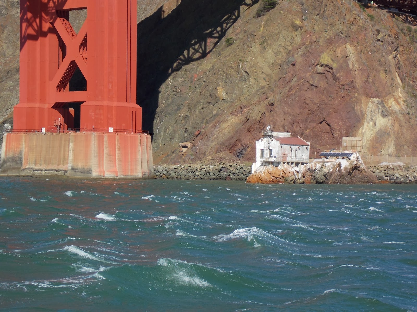


Out the Gate!

Go TBYC!!


Our Buddy Dancing Angels


Crescent City

Sea Monster?


Light House outside Crescent City


Another one outside C.C.


Sunrise


NewPort


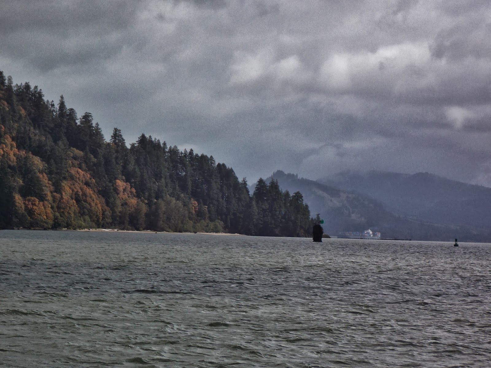
Columbia River


Home
No comments:
Post a Comment